

There are so many things to do in Baños, Ecuador. Somehow after hiking Tunguaragua Volcano, I still wanted to check out other route options for hiking in Baños. My friend had hiked a little known trail called the Sendero De Los Contrabandistas (the Smuggler’s trail/ Bootlegger’s trail/ Bandits path… you get the idea), which passes many of the waterfalls along Baños’ waterfall route, but on the other side of the river. We decided to give it another go, despite not finding much information about it online or on many GPS apps.
Despite getting lost a few times, I have to say it is worth it. I hope this post will help others interested in alternative activities in Baños, which are off the tourist trail. This route is one of my favourite day hikes in Ecuador so far and is accessible for many thanks to the optional route adaptions.
THE SENDERO DE los CONTRABANDISTAS hike information
- Distance:
The original route is on Maps.Me: 12km (5 hours)
Adaptions: between 1.5km (20-40 minutes) – 19km +(7-9 hours). See below for the different route options. - Difficulty: Moderate because there is little signage.
- Pros:
– One of the alternative things to do in Baños.
– The bandit’s trail is historical. See history below.
– Amazing views, including of some waterfalls.
– Adaptable for different fitness levels.
– Flat for most of the way.
– Free!
– Plenty of water available as long as you have a filter. - Cons:
– Little signage. Easy to get lost. See the route description below for some hopefully helpful points.
– A few not so welcoming dogs. Hiking poles help.
– Muddy! If it has rained in Baños, I recommend wearing rubber boots or at least taking them with you.
– Overgrown, so not always the clearest trail.
Sendero de los contrabandistas route options
– the original smuggler’s trail
– chinchin to san pedro waterfall
– san pedro waterfall to al placer
– the full 18km route
– a very brief history of this baños hike
– skip to a list of the main places you could get lost
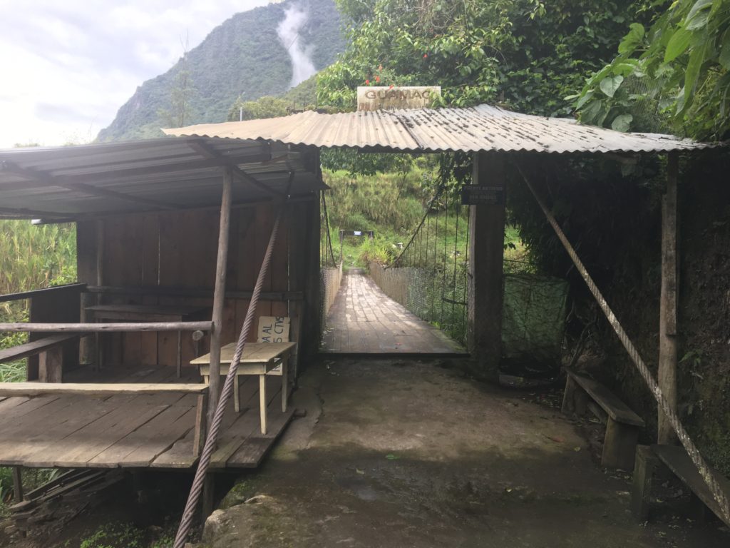
- How to get to the start? You could be ambitious and hike from Baños, but it is cheap and easy to hop on one of the public buses or trucks. Just look out for the Parque de Familia as you want to get off here, then cross back over the Pastaza River. Alternatively, a taxi should be cheap as the start is only 6km from Baños. Ask for the ‘Sendero de los Contrabandistas’; if they do not know this, ask for the Parque de Familia.
- If you decide to start at a later point of the hike with the options listed below, then ask for whatever waterfall is in that location. You will then take the cable car across the river.
- Fun fact: Mountain bike enthusiasts- check out the ‘Mama Rumi’ route in Baños, an old part of the Sendero de los Contrabandistas.
the original smugglers’ route: Agoyan – Chinchin (12km/ 3-5 hours)
Start this hike JUST AFTER ULBA ABOUT 6KM EAST OF BAÑOS. The start of this trail is signposted. it is just before the bridge OVER THE Pastaza RIVER and before agoyan dam. parque de la familia IS ON THE OPPOSITE SIDE TO WHERE THE HIKE STARTS. We parked for free outside the park. Ask for permission before doing this. we also tipped the security guard as thanks.
-
- This part of the Sendero de los Contrabandistas hike is on Maps.Me. Take caution that sometimes the GPS needs time to find your correct location due to vegetation. Alltrails and Wikilocs also have routes for this part of the hike. Like many hikes in Ecuador, there are quite a few gates to pass through. At first glance, it looks as if you cannot pass the barbed wire, but usually, there is a stick to move or part of the wire what comes off. Just make sure you close it again after you.
The start of this Baños hike is signposted. The one place we nearly went wrong was once we arrived in the Agollan community. We nearly turned right up the dirt path instead of following the left concrete path into the village. Take this one! There is a restaurant to your left, but it was closed when we passed through. You will cross a bridge and pass through a small community with many colourful flowers and an overgrown mirador.
There are also locals around to ask should you have any doubts. Just ask for the ‘Sendero de los Contrabandistas.’ Once you reach the hotel, you cross the hotel courtyard to the left instead of going straight ahead. Do not panic if the three dogs come out; they are friendly!
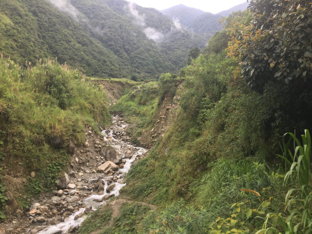
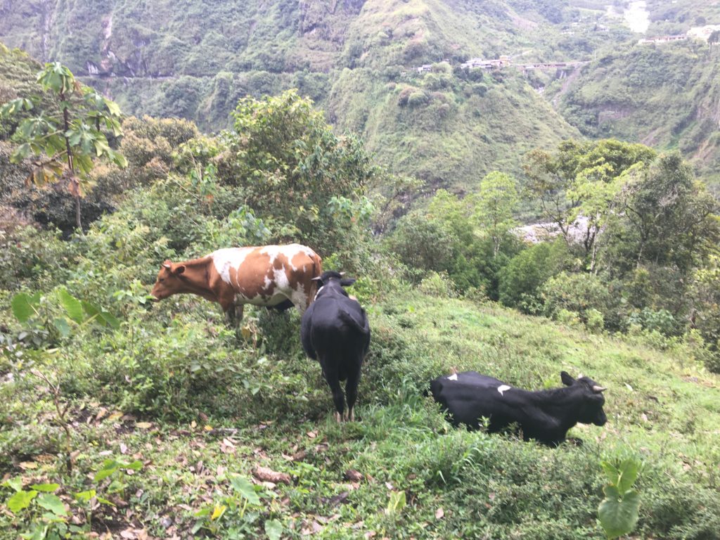
The majority of the hike can be muddy as animals such as cows more often walk this trail than hikers. However, for the first part of the hike, it is relatively flat until one ascent.
The ascent is switchbacks and took us about 20 minutes. Take your time and take as many breaks as you need. There is a great spot to rest and enjoy a snack before continuing afterwards.
the most common place to go wrong:
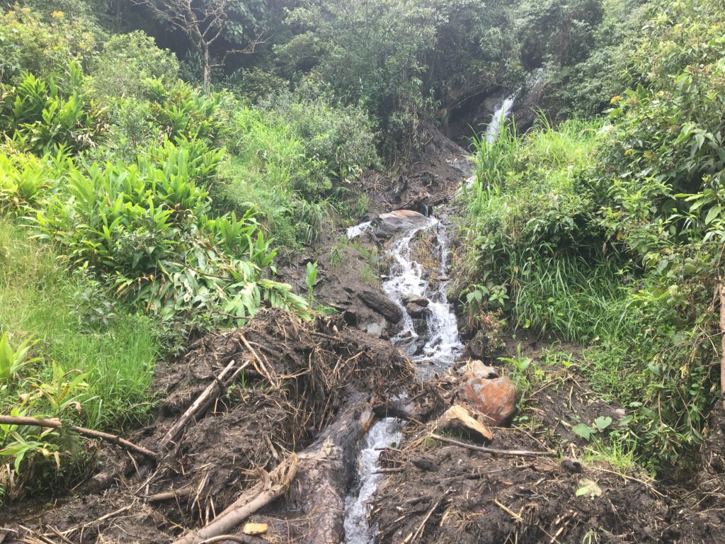
The next potential place you can go wrong is once you pass a waterfall to your right. There is a small unseen path to your left down through the field that we missed. We then reached a fork in the path, with a house ft. growling dog in front of us and a muddy but dog-free trail up to the right.
Surely the correct trail was to the right?
Luckily for us, the dog had alerted its owner to our presence, who started beckoning us over. It turns out we had missed the turning but could go behind his house on the left and follow some switchbacks down to the trail, with- surprisingly- a sign for the hike. The dog was aggressive, so I was pleased we both had hiking poles when it tried to come near us.
However, we were very thankful to the owners. We had read about people getting rescued on this hike after going up the mountain into Sanghay National Park and figured this might have been the point they went wrong.
After this, the trail was relatively easy to follow with a few signs. Until we reached an open field, with no obvious trail or sign in sight. At this point, turn left and head around along the edge of the field. Enjoy the views, and keep going straight.
After this, there were only two more instances where we questioned the trail. It did help to have Maps.Me, but the GPS was not always accurate to our location. The first instance was when we crossed a small waterfall. Cows (nice ones) were sat on the trail, and we could not tell if we should go up into the forest or stay left to follow the field. Stick to the left.
The second instance was once we were in the forest (what at times is overgrown and still muddy- of course). There was another fork in the trail, one leading down, one going ahead alongside a large rock covered in tree roots. Stick to the right and admire the rock. The trail does head up slightly, but this is correct.
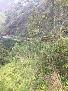
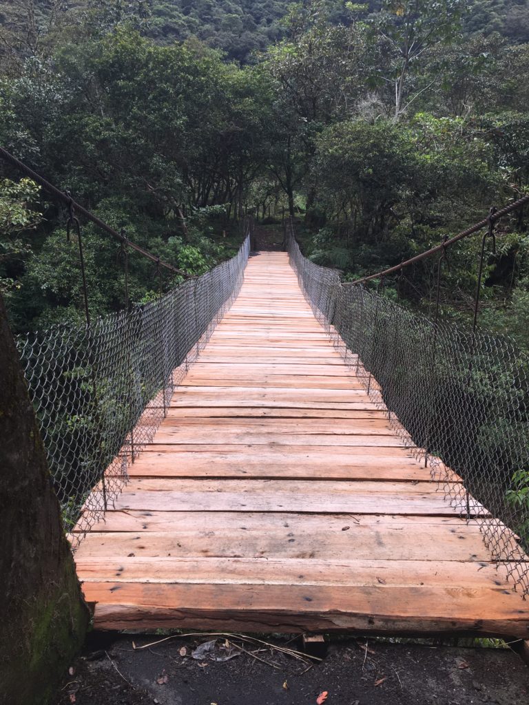
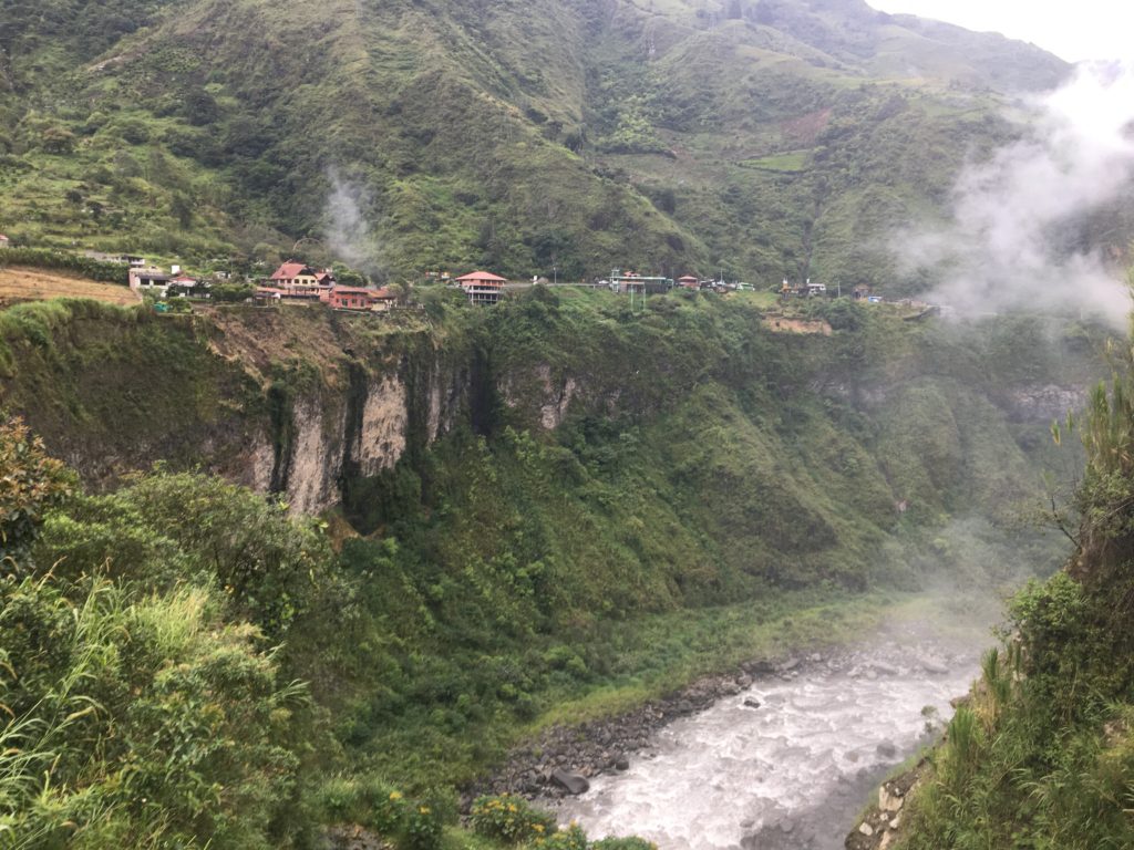
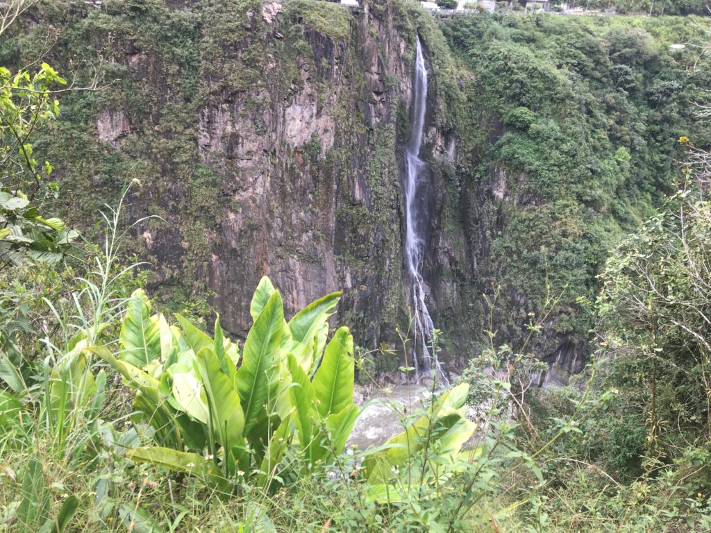
After five hours, we made it to Chinchin, where Manto de la Novia waterfall is located. There are signs, but if you would like to visit the waterfall, please know this adds around 1km one way to your trip. We instead opted to head into the community. It is well signposted. You can choose to walk through the community down and up to the other side of the river (walk through the basketball court and take the left path down) or take the cable car across. IF you choose the cable car option, make sure you look for the sign as soon as you arrive in Chinchin.
extra number one: chinchin to san pedro waterfall (1.5 km)
What would an activity in Baños be without a bit of adventure? After seeing a sign, we decided to continue to San Pedro waterfall what a local described as ’15 minutes’ or 1.5km (more or less) from Chinchin. Why? Because it was an extra waterfall to check out, and the hike was beautiful. It was only 1pm also.
This part of the Sendero de los Contrabandistas was easy to follow but soon became extremely overgrown, to the point we questioned whether it was actually a trail. But we arrived in the beautiful fairytale style village where San Pedro waterfall is located.
Again, you have the option to look closer at the waterfall.
Alternatively, you can take the cable car here, and you will get to see the waterfall.
another extra route / adapted route: san pedro to al placer (around 2km)
So, there is a sign in San Pedro to Al Placer, named the Sendero de los Contrabandistas. It looked well maintained, and we still had time, so continued. You could start here by taking the cable car to San Pedro, then walking to Al Placer, which is a small settlement. Please note you have to descend to Al Placer, then walk across a bridge over the Pataza river, and hike up the other side if you take this section of the Sendero de los Contrabandistas route. The ascent is switchbacks and only took us 20 minutes.
Once you leave the village, keep continuing straight. Do not take a left once you reach the gate, just go through it and continue. After this, it is easy to follow this path. Just make sure you turn left and descend to the river instead of taking the path straight along the middle of the mountain. This fork in the road is obvious, but there is no sign. Mud continues once you are by the bridge. It took us around one hour to reach the bridge.
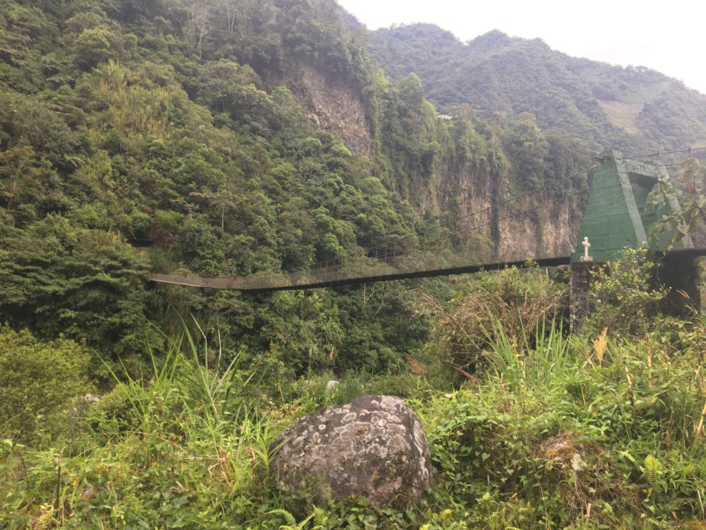
- Fun fact: Many locals use this bridge. We talked to a man who said it is possible to continue this side of the river to the Agoyan to El Pailon Del Diablo, but the route is difficult because of the many different paths. It is important to go with someone who knows the way. A little further on from the bridge is also some Inca ruins. We saw these from a distance, but I cannot confirm that they are definitely Inca ruins.
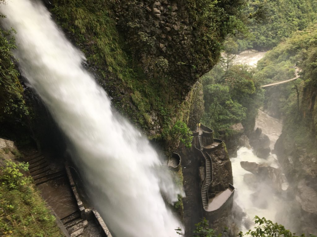
the full route… kind of: Agoyan to El Pailon Del Diablo (18km)
So the full length of the Sendero de los Contrabandistas is unclear, with little history about the route. However, you can hike all the way to the largest waterfall in Baños and the Ecuadorian Andes: El Paildon del Diablo. As noted above, unless you meet someone who knows the way on the right side of the river, it is better to cross the bridge and ascend to the road. We walked along the road for roughly twenty minutes to reach El Pailon del Diablo. It is not the best part of the hike, but the road has an allocated pedestrian path. It did feel nice to walk the whole way.
- How to return to Baños? Potentially you could hitchhike. We took a public bus back. Walk to the main bridge where there is a bus stop. We asked the bus driver to stop where our car was parked. However, there are also the trucks that run along the whole way of Baños’ waterfall route. A return trip is $5, so presumably, it would be $2.50 one way. Whatever form of transport you take, try to it on the left to view the waterfalls from this side and see how far you walked!
parts of the trail to pay attention to (aka not get lost)
Disclaimer: GPS is still recommended!
-
- Once you arrive at the first village, stick to the left concrete trail and cross the bridge. Do not take the right mud path.
- Once you cross the bridge and reach the hotel, you will arrive in a courtyard. Cross the courtyard and take the path in the right-hand corner. Do not go straight ahead.
- You will cross a waterfall to your right. Here there is a path which is the correct route to take. Suppose you are like us; you may also continue straight. The most important thing to note is you will get to a fork in the path, with a small house to the left and a path leading up the mountain to the right. DO NOT TAKE THE RIGHT PATH. Many people go wrong here, and some even have had to get rescued after reaching Sangay National Park and realizing they are lost. You either can walk back to the waterfall and find the path or walk to the left of the house. There is a small trail that joins the Sendero de Contrabandistas again. Often, the house owner helps ensure people do not take the wrong path because his rowdy dog notifies him of your presence. Avoid the dog; it can be aggressive.
- Once you reach the open field, there appears to be many paths. These are cow paths. Instead of walking straight across the field, immediately turn left and follow the path down to the edge of the field and then continue straight along the edge of the field.
- You will reach a small waterfall you have to cross. Cows were sat on the trail, so maybe it is usually easier to follow. But stay left and follow the field.
- Once in the forest: there is another fork in the trail, one trail leading down, and one straight with a slight incline alongside a large rock covered in tree roots.
- The extra section of the Sendero de los Contrabandistas: San Pedro Waterfall to Al Placer- Once you leave the village, keep continuing straight. Do not take a left once you reach the gate not long after the village. Also, make sure you turn left and descend to the river once you reach the fork in the path, with a trail going straight ahead and the trail to the left.
Do I need a guide for the Sendero de los Contrabandistas? I do not think a guide is needed, as long as you pay attention to the trail and go prepared. However, if you would like more information about this Baños hike, a guide would be useful as there is not much information online or on the trail.
TIPS FOR HIKING SOLO AS A WOMAN
the history of the sendero de los contrabandistas
Well, there really is not much information out there. However, smugglers used the Sendero de los Contrabandistas to smuggle cane liquor out of Baños when alcohol was prohibited in the twenties. One of the most common smugglers on this route was Fidel Fiallos, who was Carmen Luna de Currat’s grandfather, supposedly also known as the most famous smugglers at the time. If you know any more information, please comment below!
more SOUTH AMERICA POSTS


1 Comment
Pingback: Best Things to Do in Baños, Ecuador - travelface